What's up with the
|
| back to Sterling Section main web site |
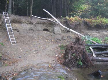
The south bank of the Lamoille River is changed each year as the river floods - usually in the spring.
This means that the trail route through this area is hard to find in the spring at the start of the hiking season.
You can see in the upper picture that a blaze tree has been undercut and fallen into the river bed. This tree was pretty big, and also a little ways back from the bank of the river, but still it washed out.
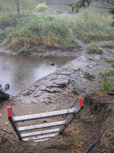
Ladders placed against the bank seem to last through the hiking season, but are washed away in the spring. (Yes, we try to pull the ladder out for the winter, but folks hike through later and end up returning the ladder to the backchannel so they can use it.)
So, the maintenance job is to go to the site each year after the spring floods and reestablish a clear route for the LT through the backchannel area. Otherwise, hikers get off track and end up exploring quite a ways side to side along the river looking for where to pick up the trail again . . .
Photos by Greg Western.