Sterling Section
of the Green Mountain Club
| Upcoming Events |
| ABOUT US: |
| Welcome! |
| Membership |
| Trips |
| Trail Work |
| History |
| Stories |
| OUR TRAIL: |
| Overview |
| Hiking |
| Camping |
| Map |
| Useful Stuff |
| Links |
|
"The Long Trail is an invitation - Mountain high and tree embowered - A free open and easy path that begins where Vermont begins . . . " - James P. Taylor Founder of Green Mountain Club, 1910 |
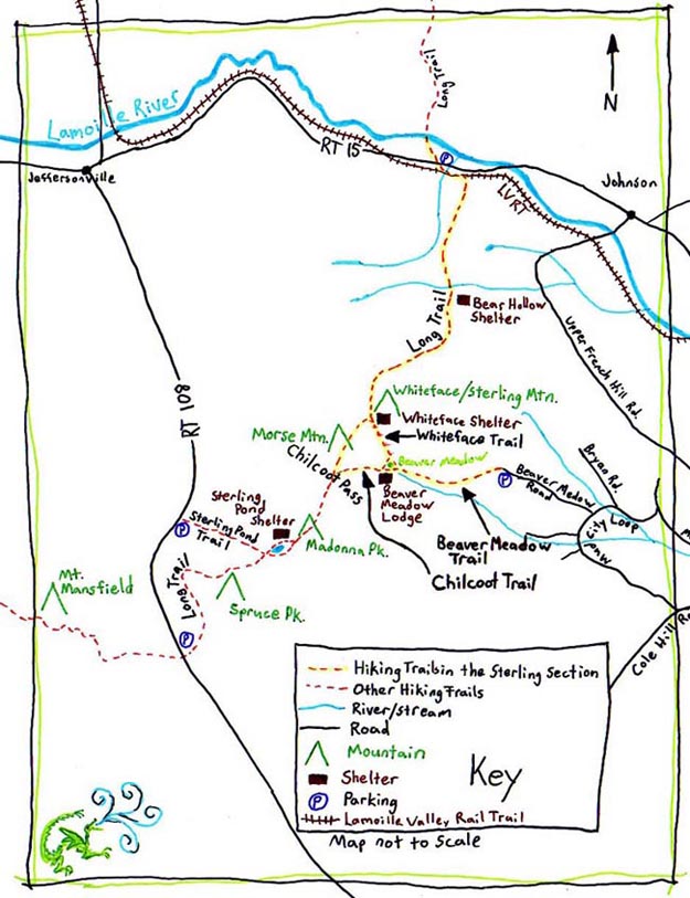
Trail Map |
||||
|
Here is a handy drawing. This sketch introduces trails, access roads and some natural features of the Sterling Section. (For larger context, remember that our Section is in the north/central part of Vermont.) Detailed maps, guide books and hiking information are available by contacting Green Mountain Club. (Web: www.greenmountainclub.org; Office: 4711 Waterbury-Stowe Rd., Waterbury Center, VT 05677; Phone: (802) 244-7037.) |
||||
 (drawing by Zyla Nuite.)
|
||||
|